How to read a swell forecast: the complete guide to surfing better
Height, period, direction, wind, tide: learn to read a surf forecast like a local. The Swellr guide to never missing a good session again.
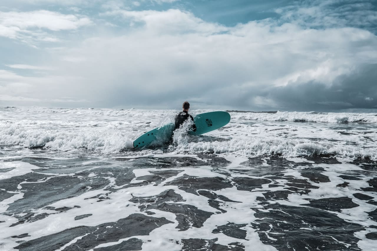
6 a.m. The alarm just went off. You open your surf forecast app and see this: 1.4m / 13s / W / NE 12km/h. What does this gibberish mean? Is it worth getting up, loading the board onto the roof, and driving 40 minutes?
Most amateur surfers make their decision based on instinct, or worse, solely on the height of the swell. The result: wasted sessions, wasted trips, and sometimes uncomfortable situations in the water.
Reading a surf forecast means reading five variables at the same time: height, period, direction, wind, and tide. Each one counts. Together, they give you an accurate picture of what to expect in the water.
After reading this article, you'll know exactly what to look for, in what order, and how to interpret each number.
Wave height: a figure that should not be taken literally
This is the first figure everyone looks at. 1.5m swell, great or not? The height alone tells you almost nothing.
What the forecast shows is the significant height: the average of the largest third of waves over a given period. If the app says 1.5m, expect waves between 1m and 2m, with a few sets exceeding that.
Here's a quick guide based on your level:
| Swell height | Recommended level | What you can expect |
|---|---|---|
| 0.3–0.6 m | Beginner | Small, gentle waves, ideal for learning |
| 0.6–1.0 m | Beginner/Intermediate | Regular waves, comfortable in the water |
| 1.0–1.5 m | Intermediate | Powerful, good positioning skills |
| 1.5–2.0 m | Intermediate/Advanced | Selective, be careful with sets |
| 2.0 m and above | Advanced/Expert | Powerful water, reading the spot is essential |
Here's the catch: 1m at La Côte des Basques with a sandy bottom and rising tide is a pleasant session for an intermediate. 1m at La Gravière with a hollow sandbank bottom and low tide will knock you off your board at the slightest mistake. Same number, totally different experience.
The height must always be read in relation to the bottom, the tide, and especially the period.
In Swellr, height is contextualized by spot. You can see immediately whether it is suitable for your level.
The swell period: the figure that everyone ignores
If you only remember one thing from this article, it should be that period is the most important criterion, and the most overlooked.
Period is the time in seconds between two consecutive waves. It's a figure that changes everything when it comes to water quality.
Here's a mnemonic rule:
- Less than 8 seconds: wind swell, short and disorderly. The waves are soft, messy, and difficult to catch. This is what we call a windy sea. Technically surfable, but frustrating.
- Between 8 and 12 seconds: transitional swell. Conditions are decent, waves are more organized. This is what most sessions in the Basque Country are like in the fall.
- More than 12 seconds: ground swell. The swell has traveled far, it is organized, powerful, and regular. The waves have shape, wall, and speed.
Two forecasts in Hossegor to illustrate.
Scenario A: 2m / 7s. On paper, 2 meters sounds appealing. With a 7-second period, the waves arrive too fast, too short, too soft. It's difficult to find a good wall. Lots of paddling for little gliding.
Scenario B: 1.5m / 14s. One meter fifty. With a 14-second period, it's a well-formed Atlantic ground swell. The waves roll cleanly, they have length and power. The locals get up early that day.
Scenario B is a memorable session. Scenario A is a maintenance session.
The longer the period, the deeper and more stable the energy of the swell. That's what produces quality waves.
Filter your alerts by minimum period so that you only receive notifications when the conditions are right.
The direction of the swell: it all depends on your spot
A swell comes from a specific location. Depending on its origin, it amplifies or dissipates depending on the geography of your coastline.
On the French Atlantic coast, the most common directions are:
- NW (Northwest): swell coming down from the North Atlantic, often linked to Icelandic depressions. It hits the coast at a low angle. Certain headlands attenuate it.
- W (West): the reference direction for the Basque Country and the Landes region. A clean swell that hits the coast perpendicularly. This is what feeds La Gravière.
- SW (Southwest): swell coming up from the South Atlantic. Ideal for certain south-facing spots.
Some concrete examples in the Basque Country:
- La Côte des Basques (Biarritz): exposed to SW and W. The south-west swells arrive well, and the cape of Biarritz provides some protection from overly pronounced NW swells. Accessible spot, suitable for intermediate surfers.
- Hendaye: the most protected spot on the coast. The orientation of the bay filters out large swells. Ideal when conditions are too rough elsewhere, it only comes alive with well-oriented SW swells.
- La Gravière (Hossegor): fully W facing. It takes everything. A W / 14s swell here is one of the best beach breaks in Europe.
The direction must always be cross-checked with the morphology of the spot. A spot in a bay will be more selective than a beach facing due west.
Each spot in Swellr has its optimal directions pre-configured. You don't have to think about it.
Le vent : offshore, onshore, cross
A magnificent swell on paper guarantees nothing if the wind changes. It is the most volatile variable, the one that changes most quickly during the day.
There are three scenarios:
- Offshore (wind from land): the wind blows from the coast out to sea. It slightly lifts the lip of the waves, smoothing them and making them hollow. These are ideal conditions.
- Onshore (wind from the sea): the wind blows from the sea towards the coast, in the same direction as the waves. It flattens them, making them soft and messy. Even with a good swell, the waves have no shape. The result: frustrating sessions.
- Cross-shore: the wind comes from the side, perpendicular to the coast. Conditions vary depending on the intensity and exact direction.
A practical tip: get up early. Thermal winds generally set in at the end of the morning when the land warms up. The best conditions are often between 7 a.m. and 10 a.m., when the air is still calm or slightly offshore.
Activate an offshore wind alert for your favorite spots to receive a notification the day before when conditions are right.
The tide: the forgotten ingredient for beginners
The tide is often the last variable we consider. However, it completely transforms a bottom spot.
The impact of the tide depends directly on the type of bottom:
| Type of seabed | Ideal tide | Why |
|---|---|---|
| Sand bottom (beach break) | Mid-tide, often falling | The sandbank is well covered without being too flat |
| Rocky bottom / reef | Rising tide or mid-high tide | Enough water to avoid shallow rocks |
| Sheltered beach (Hendaye type) | High tide | The swell enters the bay more easily |
| Hollow beach break (Hossegor type) | Low tide to mid-tide | Sandbanks are more exposed, waves are hollow |
For beginners, here's a simple tip: avoid low tide at unfamiliar spots until you've familiarized yourself with the bottom. Tide times vary by about 50 minutes each day.
Tide times are integrated directly into each Swellr spot page.
Case study: reading a forecast together
Let's move on to the practical side. Here is a fictional but realistic forecast:
Thursday, Hossegor / La Gravière
Height: 1.4 m | Period: 13 s | Direction: W | Wind: NE 12 km/h | Tide: falling, low at 10 a.m.
Let's break it down, variable by variable:
- Height: 1.4m. Fair. Not huge, but very surfable for an intermediate. We're not battling monsters here.
- Period: 13s. Excellent. We're clearly in ground swell territory. The waves will be well-formed and consistent. That's the number that makes all the difference here.
- Direction: W. Perfect for La Gravière. Full west swell, spot exposed to the west. The energy arrives without obstacles or unfavorable angles.
- Wind: NE 12km/h. NE from the coast, offshore for the Landes and the Basque Country. 12km/h is light. The waves will be smooth, the lip combed. Ideal conditions.
- Ebb tide, low tide at 10 a.m. At La Gravière, the sandbanks are exposed at low tide and produce more hollow waves. Be in the water before 9 a.m. to catch the best window.
Verdict: A session not to be missed. 1.4m may seem modest, but the combination of long period + offshore wind + perfect direction + favorable tide makes for a quality session. It's not the size that counts, it's the shape.
Your checklist before loading up your board:
- ✅ Is the height suitable for my level?
- ✅ Period greater than 10s (ideally 12s+)?
- ✅ Is the direction favorable for my spot?
- ✅ Offshore or calm wind, at least in the morning?
- ✅ Is the tide compatible with the bottom of the spot?
Tools for reading your surf forecasts
There are several tools available for reading forecasts. An honest overview:
- Windguru: the benchmark for raw data. Complex interface, difficult for beginners to read. Perfect if you want all the weather details.
- Surf-Forecast: more accessible than Windguru, good coverage of European spots. Clear interface, star rating useful for initial filtering.
- Magicseaweed (MSW): solid for international spots, good community. English-language interface, less focused on the French Atlantic coast.
- Swellr: designed for French surfers. Data is contextualized by spot, not just raw numbers. Readings adapted to each beach, customizable alerts, and integrated tide schedules.
Best practice: cross-reference at least two sources. Weather models are not infallible, and small discrepancies between them give you an idea of the reliability of the forecast.
We've covered the five variables that make for a good session. A quick recap:
- Height: refers to the size of the waves, which should be considered in relation to the spot and your skill level.
- Period: the key criterion for quality. The longer, the better.
- Direction: each spot has its favorite exposures. Learn yours.
- Wind: offshore in the morning is often the perfect window.
- Tide: the subtle ingredient that changes everything depending on the seabed.
Once you've mastered these five variables, surf forecasts will no longer intimidate you. You'll be able to make a decision in seconds and get up with confidence when it's worth it.
The perfect session can't be improvised. With the right tools, it can be prepared in two minutes.
Mets la théorie en pratique
Test Swellr in preview